 Climate change negotiators agreed Sunday to monitor deforestation and to pay developing countries for keeping carbon trapped in forests. To measure just how much forest those countries are conserving, the United Nations Collaborative Program on Reducing Emissions from Deforestation and Forest Degradation in Developing Countries (REDD+, to its friends) will rely on a complex system of satellite measurements and field checks. The agreement is a victory for advocates in the research and conservation communities. Yet they face a lot of work implementing the program. Many countries and agencies already have experience conducting their own long-term monitoring, but the programs often differ in their goals and methods. That makes their data hard to compare. For example Brazil spent US $1.4 billion on a satellite system a decade ago for monitoring the Amazon, but some researchers accused it of being more of a drug-smuggling interdiction tool than a forestry tool. And the U.S. National Oceanic and Atmospheric Administration (NOAA ) has been monitoring wildfire-driven deforestation since the 1980s, but that is not suited to monitoring illegal logging because the two forms of deforestation occur on different timescales. Earlier this year, Nature published a commentary by researchers and satellite builders calling for a single international standard for forest-monitoring data.
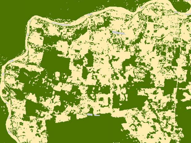
A Finnish-led team has been working on a more technical forestry problem: how to combine the various bands of data satellites can collect. Optical data, such as that provided by the Landsat system, are common, but do not penetrate the clouds that often cover tropical forests. The team found that they could boost their ability to estimate forest cover and degradation by including radar data, they reported earlier this year in IEEE Journal of Selected Topics in Applied Earth Observations and Remote Sensing. The project, called ReCover, collected satellite data in multiple bands from forests at five study sites and compared satellite-based interpretations to measurements of forest cover and quality on the ground. Their first-pass analyses achieved from 75 to 91 percent accuracy in forest classification, depending on the method, but combining methods should help them improve.
First published on IEEE Spectrum’s Tech Talk blog: [html] [pdf]